The Path
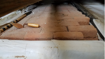
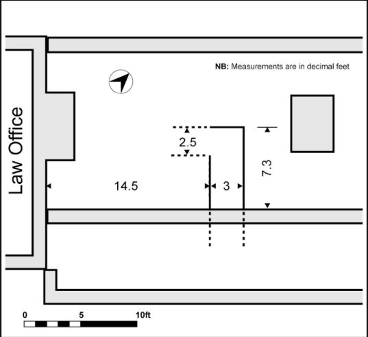
Through GPR analysis, we found evidence of the path extending from the Law Office. This confirms the preliminary site investigation, which shows an exposed brick pathway under the second room of the range between the Main House and the Law Office.
Upon initial examination, the path mapped out through the GPS data appears to be connecting the Law Office to what is presently a vehicular driveway. However, upon further analysis, we conclude that there are multiple possible explanations for the direction toward which the path was headed. These explanations would also illuminate the path’s intended use.
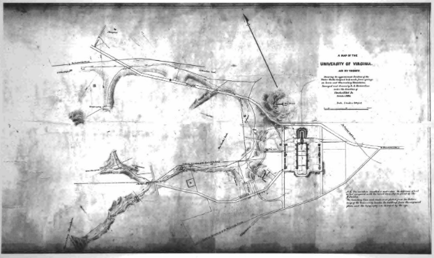
The path dates anywhere between the construction of the Law Office around 1790 and 1856, where the path has clearly disappeared on “A Map of the University of Virginia” dated that year.
In addition, because we know the construction of the ranges, dated 1848, likely would have covered up a portion of the path (rendering it unusable), we can postulate that the path existed between c. 1790 and 1848. Therefore, it becomes logical to discern major events that took place in this date range in order to identify a more precise date of the path’s existence. Once the date of the path’s existence has been established, we can better narrate the story of the path, the site of Monroe Hill, as well as its relationship to its surrounding context.
Land use maps, in this case, become particularly useful. These maps can show the different types of land use around Monroe Hill and the change overtime. Therefore, they can reveal the important relationships between different parts of the landscape that can be critical to our interpretation of the path. From the land use map of 1790,
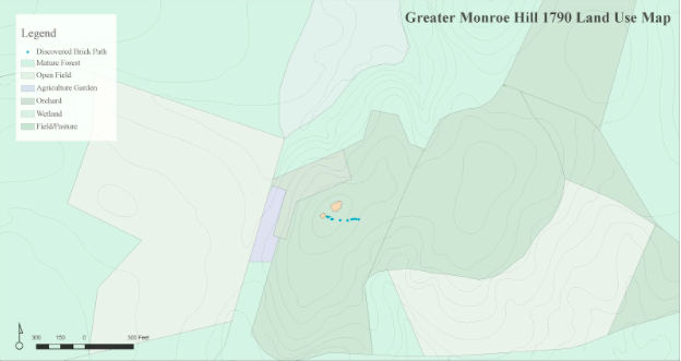
the path appears to be headed from the Law Office toward an area of the land that was classified as field/pasture. Documentary evidence describes the presence of farmland, or what Monroe would have described as his “lower plantation.,” in that area. This supports our explanation for where the path connected to and its intended use--it is possible that the path had been constructed around 1790 along with the Law Office, and it was used to connect the Law Office to Monroe’s lower plantation. However, when the ranges were built in 1848, it may have been decided that the path was no longer practical because it was going to be covered up. As a result, the path was erased from the landscape.
Through the analysis of the land use change overtime of the greater Monroe Hill area, we can see that a major change had occurred in 1819/1820
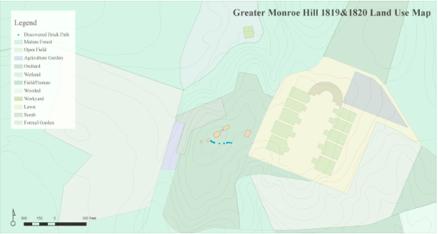
in the area that used to be Monroe’s lower plantation. This date, of course, marks the inception of the University of Virginia. The creation of the Academical Village began to materialize with the completion of Pavilion VII in 1819. Our second explanation for the identity of the path, therefore, revolves around the possibility that the path headed toward the Academical Village. It was possible that the brick path was not constructed when the Law Office was built, and that it was not until 1819/1820 that the path was created in order to provide access from the Law Office to UVA. Once again, the path may have disappeared with the construction of the ranges in 1848. This second explanation dates the path between 1819/1820 to 1848.
The second explanation is further buttressed by documentary evidence. It was recorded that a large number of bricks were purchase around this time. While this remains a speculation, it is possible that some of the bricks that were purchased went to the paving of the brick path. Perhaps the construction of the Academical Village posed a need for access from the Law Office to UVA. Bricks were thereby purchased and used for the path, fulfilling the need to have access between the Law Office and the Academical Village.
An additional explanation for the date and direction of the path is based on evidence of existing roads in the area before the Monroe Hill dwellings were constructing, suggesting that the structures were built after the road, and the pathway was constructed to connect residents to existing services.
Before buildings were constructed on Monroe Hill, Three Notch’d Road likely already existed, following the route of Main Street and University Avenue. In 1745, landowners petitioned the Albemarle County Court for a new road that would connect Benjamin Wheeler’s property into the Four Chop’t Road to Wood’s Gap. The new road went from the eastern section of the Academical Village and south. The Albemarle County Road Orders from 1725-1816 suggest that the Three Chop’t Road likely existed where the present day McCormick road is. The road would have “avoided the swampy headwaters of Meadow Creek and instead followed high ground,” thus suggesting that there was a road at the site predating the construction of buildings on Monroe Hill.
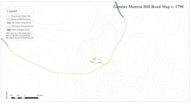
One of the potential explanations of the path is that it was constructed from the Law Office to Three Chop’t McCormick Road during the 1790s construction of the Monroe Hill Dwellings. Since the Law Office was likely finished first and the primary Monroe residence during the 1790s, it makes sense that the path would have gone from the Law Office to the road that connects to the rest of the Charlottesville area. This drawing illustrates the relationship between the brick path that we have discovered through GPR and the roads leading to the greater Charlottesville area around 1790.