South Field
The Resource
Throughout most of its history, Birdwood has been a working farm, including cattle, crops like tobacco and wheat, and even an apple orchard. A substantial farm infrastructure was built and modified over time to support this enterprise. The original Birdwood farm was about 1,000 acres when William Garth purchased the property in 1810. He later constructed the main house and main outbuildings some time between 1819 and 1830. At the time the Garth family sold Birdwood to Samuel Buck in 1879, the main house included 529 acres of land. Currently, the Birdwood property sits on about twelve acres and is owned by the UVA Foundation.
The Birdwood mansion house is flanked symmetrically by four outbuildings, two to the east, the icehouse and a garage, and two to the west, a kitchen and Smokehouse. From the main house there are beautiful views of the mountains. Beyond the outbuildings, further to the south, is a terraced field we call the South Field, with an early 19th century stone double cabin on the east end and an early 20th century stone barn to the west. 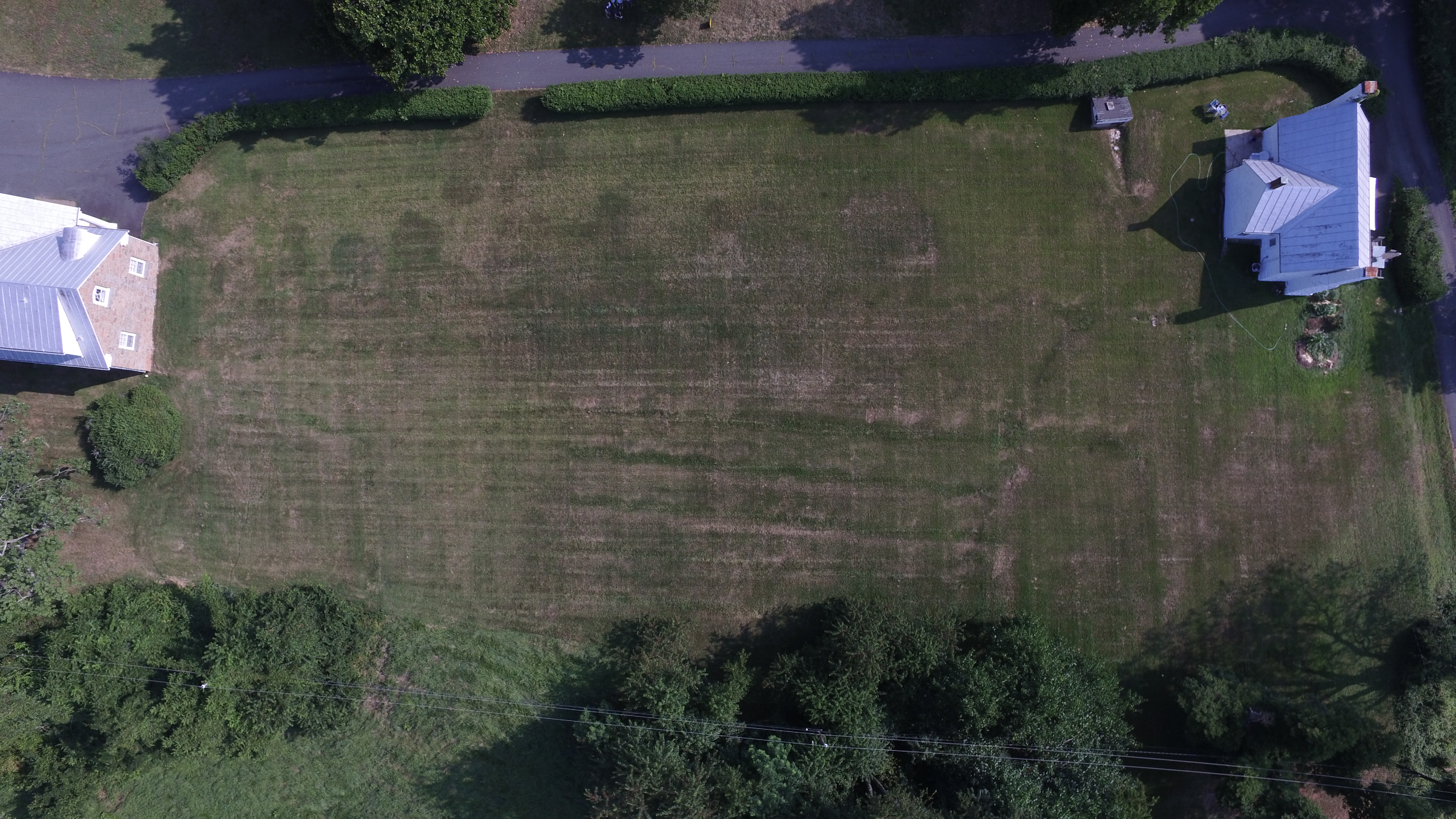 The South Field (right, click to enlarge image) is sloped away from the main house and has a prominent hedge and path separating the field from the backyard of the mansion. Currently beyond this field is the Birdwood golf course, driving range, and other modern golf support structures, all on land once part of William Garth’s farm.
Our Question
The class hopes to discover what the South Field might have been used for in the past and what, if any historical significance can be attributed to the site. This field may have been used as a work yard or vegetable garden at one time. It may have also had farm buildings or other storage sheds on it. The South Field is in close proximity to the main house, and anything built on this site could potentially disrupt the sight lines from the main house. Consequently, there is a possibility that little has changed in the South Field since the 19th century. The stone double cabin is commonly referred to as a slave cabin, but little is known of its history and it may predate the Birdwood mansion house. In the first period of Birdwood, when William Garth bought the land and built his home between 1819 and 1830, there is no record of anything in the South Field, but something could have been there earlier. 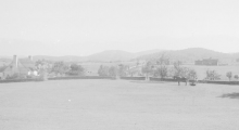 Historic photographs from the Holsinger collection (left) at the UVA Library show images of the farm at Birdwood in 1917 and 1918, but do not distinctly show anything in the South Field. There is the possibility that shorter structures were built but in combination with the hedgerow and the sloping ground, they are not visible in the photos.
Our Inquiries
During the class’s initial site visit to Birdwood, Jim Wilson from the UVA Foundation answered questions about the property and South Field. The class also conducted research at the Albemarle County Courthouse and found William Garth’s will, as well as an estate auction from 1868 detailing household items, livestock and crops, but it did not give a clear picture of farm structures or outbuildings. There was also an 1878 survey map of the property (below right), but no buildings were shown in the South Field at that time. While investigating the field prior to ground penetrating radar (GPR), the class also interviewed the current resident of the stone double cabin. To his knowledge, nothing has been in the South Field for the past four years, although in digging his garden to the south of the cabin he found deposits of charcoal and broken brick. 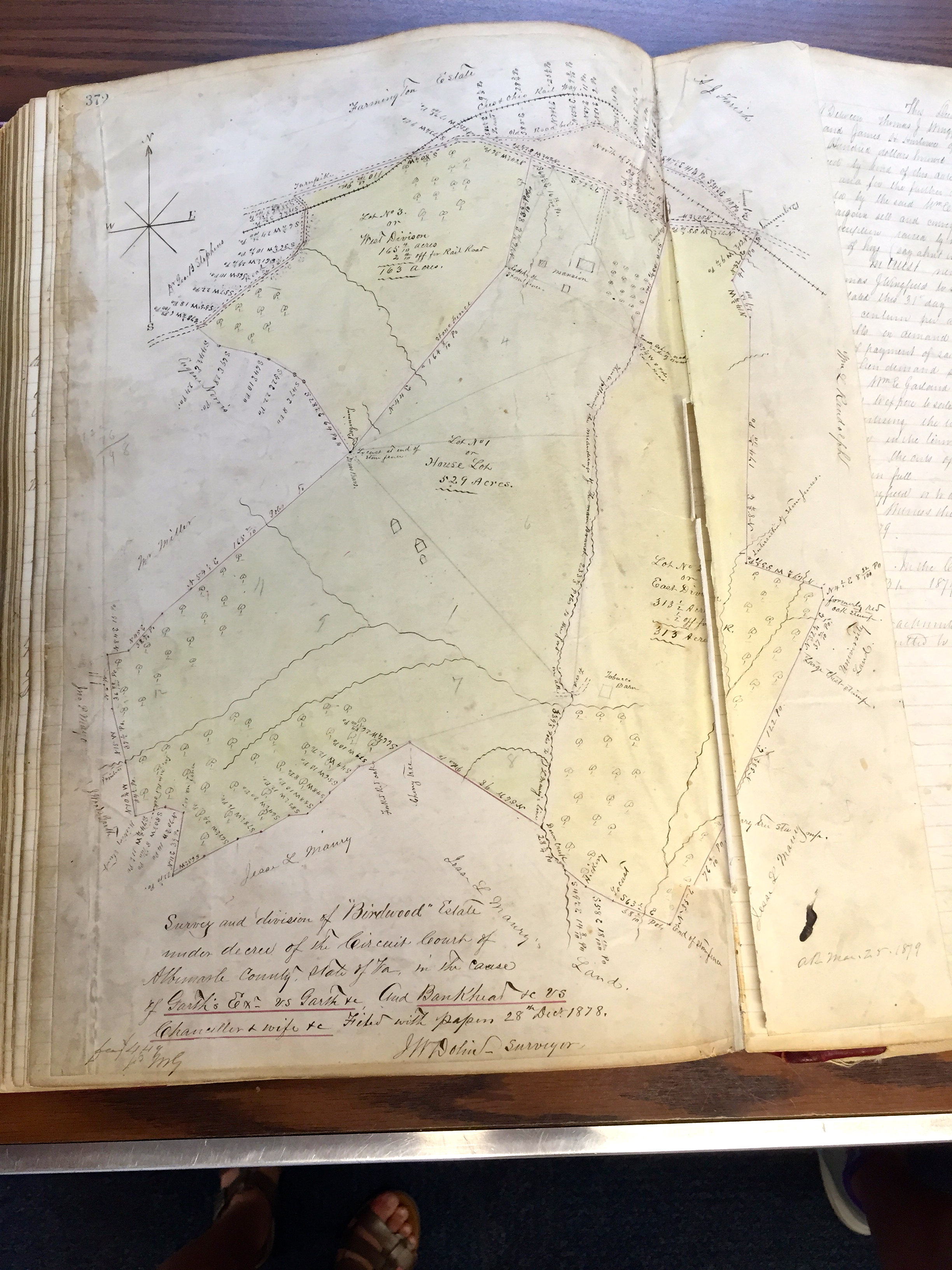
Google Earth images showed clear color and growth variation in the South Field. Aerial photographs and video that Arin Bennett from the UVA Library was able to take using a quadcopter drone also show markings in the ground, similar to Google Earth. The South Field has noticeable patterns in its vegetation, some of which are circular and some are more rectilinear. The circular patterns may be a fungus in the grass. The more rectilinear shapes we decided to investigate further, as they could represent buildings of some kind. This field was identified as an area for GPR inquiry, to see if anything could be detected beneath the grassy surface.
Data and Results
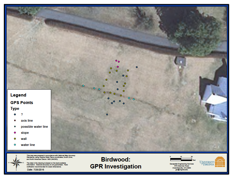
Matthew Bartley, Geospatial Engineering Technician at UVA, and student intern, Mohamed Ihsan, visited the class and used a new US Radar GPR machine (that resembles a lawn mower) to make passes over a prominent dark marking in the corner of the South Field, nearest the stone cabin. A series of GPR transects were run east to west, then north to south over the area. The monitor on the GPR machine shows parabola-shaped disturbances whenever the machine encounters something that the radar reacts to. At each encounter a marker flag was placed in the ground. The marker flags were geo-located and are shown on the accompanying map. Eventually a shape emerged with rectilinear features. The South Field slopes from north (top) to south (bottom) as shown on this map:
Analysis and Interpretation
Working with Matthew and using his expertise, the class interpreted the GPR data as follows:
· A known modern water line, bisecting the site east-west (image below right)
· Linear features interpreted as “walls” formed a rectilinear shape roughly 20x25 feet
· A slope on the uphill side of the rectilinear shape, descending to about 4 feet below ground level, adjacent to the back “wall”
We speculate that the rectilinear shape might be some sort of agricultural or domestic structure that was either a low structure not visible in the Holsinger photos or predates the photos. One could speculate that the South Field was used for farm buildings, storage sheds, other domestic structures, such as cabins for the enslaved, given its close proximity to the stone double cabin and the main house.

Next Steps
Further archaeological research is necessary to determine what sort of structure might have been in the field and how old it might be. Shoveled test pits would be an initial way to dig down deep to bedrock and pull up any items from the pit that was dug. Small pits would be dispersed 2-3 meters apart in the area identified by GPR. Once the soil and any found items are scanned, if there are items of domestic refuse (broken bits of pottery, animal bones, etc.), further archaeological excavation can occur.
Archaeological investigation would be especially important to do before any construction is done in the South Field. Due to the South Field’s close proximity to the main house, future planning for Birdwood may necessitate a more thorough archaeological investigation of this field. If new construction is planned in the future at Birdwood, it would be important to know the significance of the space, especially since the stone double cabin is from the same time period as the main house, or earlier. Many questions still remain about the South Field, but using technology like aerial photography and GPR encourages further investigation.