The initial visual scan did not have significant returns. The aerial/drone photography was interesting to see because it allowed us to take a look at the area from a different point of view. However, the drone photography was similar to the visual scan in that we didn’t discover much of anything new.
Image 2: Photographs of the leeching field, left, and the granary and silo, right.
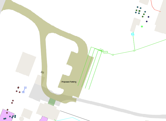
We were able to successfully scan their requested areas as well as our desired locations, and ultimately, we came away some interesting information. The returns from each pass can prove difficult to interpret, but they can also offer a lot of information from which we can draw different information. The scans can show changes and disturbances to the locations, be it changes in the grade of soil, or other items below the surface. Comparing these scans to older maps of the location, we can draw inferences as to what the GPR picked up on. Before we began our scans, Matthew Bartley, Geospatial Information Specialist from Facilities Management, showed us a proposed map of an old leeching field, with lines of parallel pipes reaching away from the house, where the parking lot would be located. We would later find what seemed like a more modern drainage pipe beside the carriage house, as well as the remnants of the leeching field where the map suggested.
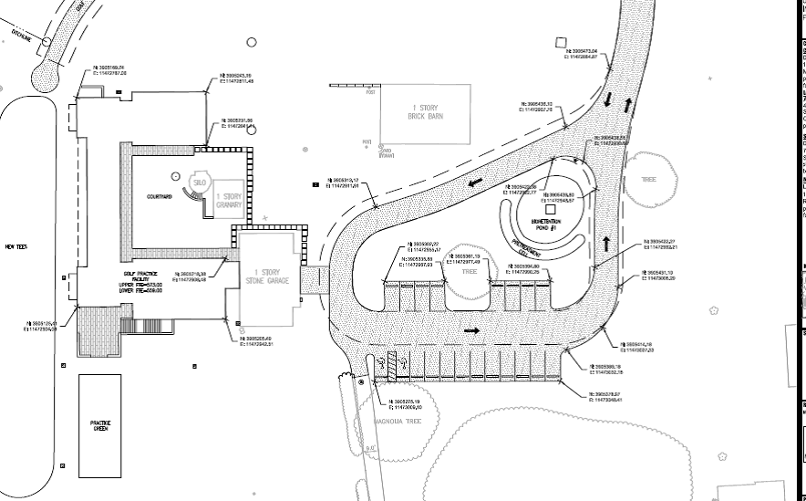
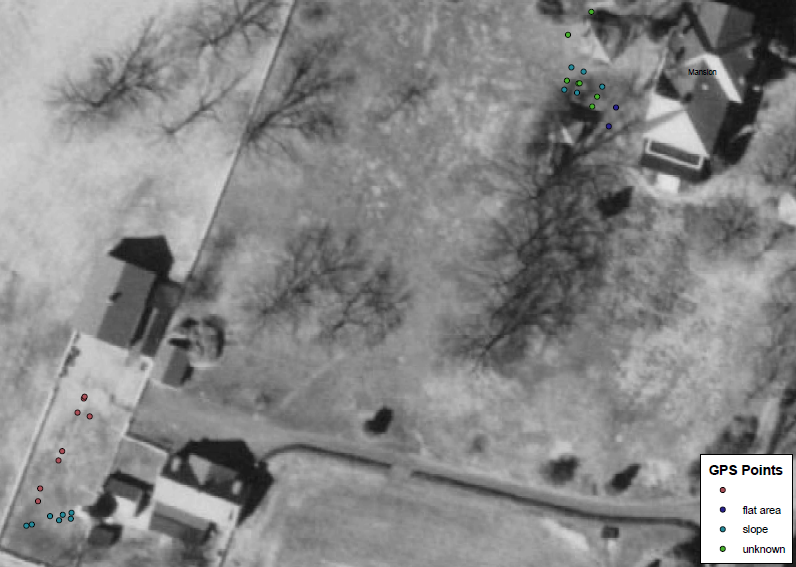
Image 3: This particular image shows three things: the plans for the practice facility, the leeching field, and GPR data points. The mansion is located at the top right of this photo, facing north. To the left of the building to the left of the mansion. The GPR points are three different colors. Dark blue is a flat area, light blue is a slope, green is an unknown point, and red is a modern drainage pipe.
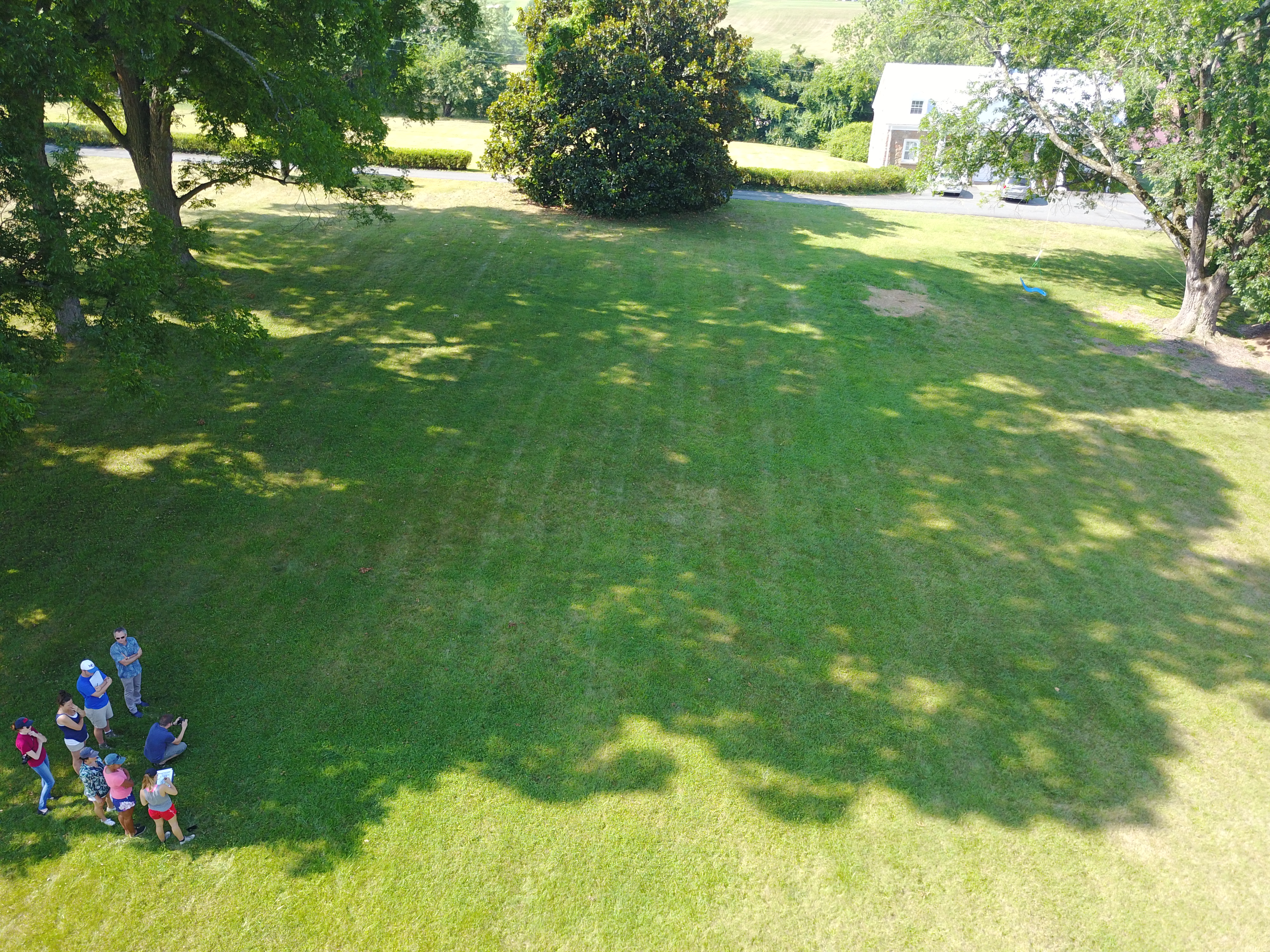
Towards the bottom left of the above image, there are a series of dots that show the location of points we mapped that were of interest to us, located in the yard next to the carriage house and silo. We scanned this location at the request of the UVA Foundation. We found that the points were once what might have been a wall or fence line outlined a work yard area as well as a slope that was filled in to level out the area. This work yard space may have been an area where general farm work or maintenance occurred, like any farrier work, preparing or repairing carriages and other farm equipment. Moving towards the back of the carriage house, the ground seemed to be sloped, and that soil had later been filled in to even out the grade of the area. The UVA Foundation do not need to use caution around this area in chance of disturbing anything of excitement or importance.
Image 4: This is a 1963 photograph of the areas in question, showing clearly the space next to the granary and silo. Here we can see the shape and worn areas of the yard, with which was can hypothesize the uses of this area.
We also scanned both the leeching field and between the two big trees, where the parking long would split from the entrance road and come closer to the mansion. Not knowing if the leeching filed was there or not, we did big sweeps of the area to lay down some idea of where we need to look next. After a few passes, we discovered that the drainage system is still there. We did other scans of the area, moving away from the drainage lines, to see if there were anything else that would prove of consequence. We found mostly tree roots in the area.
As for our own research, we simply wanted to see if there was anything around our building of focus that would help us interpret the kitchen more. We scanned areas between the smokehouse and the kitchen, as well as around the kitchen itself. We found a few points between the smokehouse and the kitchen that suggested changes in the grade of the soil. It seemed that between the two buildings, the soil slopped downwards and away from the mansion and formed a walkway or drainage area. We also found that there was a brick walkway stemming from the kitchen to the mansion and other outbuildings. There was also a path on the back side of the kitchen, the side that faces away from the mansion, that is simply worn down from being walked by so many people so often in its time. With these walkways, we can get a better sense of how much the kitchen was used and how central it was to other spaces or location that were contributing to the productivity of the mansion at its prime. These results show how useful the GRP is. If the class was interest in doing an archeological excavation of a site at Birdwood, the GPR would allow us to find spaces if interest and eliminate larger trial and error sampling locations where we think we could make significant discoveries. With this in mind, it would be interesting to further investigate the slope and areas around the kitchen. The class would also like to know where a trash midden is located, to potentially discern more information about the house and everyday life at Birdwood, and perhaps GPR can be used to help locate that as well.
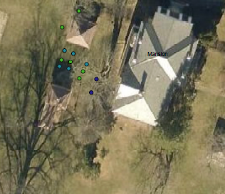
Image 5: The plots of slope and pathway that we found in reaction to the kitchen, on top, and the smokehouse, just below the kitchen. From this image, we can see that the slope between the kitchen and smokehouse is mostly symmetrical. The Dark blue spots represent flat areas, the light blue spots represent sloped areas, and the green spots represent unknown information about the anomalies under the soil.
In the end, GPR has made part of our research of both the mansion and the kitchen exciting, interactive, and very useful. GPR has allowed us to view the plantation in a manner beyond the scope of our own eyes. Seeing all the layers beneath the soil is fascinating, through the anticipation of discovering what is to be found. This technology is more than just looking for physical items, but also looking for the footprint that was left behindthe people before us, in finding walkways and drainage that used to exist, but is now lost to the naked eye.