
Analysis of Maps and Land
Figure 1: 1878 map with buildings outlined of original settlement and cemetery (bottom left with pentagon-shapes), the two barns from a 1900s Holsinger photo as ovals, and the manor with associated houses in the upper right.
On a map of Albemarle County from 1875, J. W. Garth is named on the Birdwood land parcel (he had been gifted the land by his father, Thomas Garth Jr, between 1802 and 1811 according to land deeds). In 1878, a "Survey and Division" was done on the land parcel entitled the "Birdwood Estate". This survey indicated three land parcels with number one (No. 1) called the "House Lot," which stretched past Morey Creek and Birdwood Pond, and near which the cemetery and the original settlement were located. From the early 19thcentury, the Garths made many land deals, and were significant landowners in Albemarle County. However, through all of these different land exchanges, the House Lot never left the possession of the Garths, passing from Thomas Sr. to Thomas Jr, to Jesse W., and to William Garth.
The Garth family sold the Birdwood property to Samuel Buck and William Chamberlain, who made changes to the property including planting many trees throughout the yard from 1879-1908 some of which still exist today (Figure 1). Hollis Rinehart was the next to purchase the area, working on the land from 1909-1920 (Figure 2). Mr. Rinehart also owned the land on the other side of Ivy Road, now Route 250, where he built other large homes for his children, as well. Following 1920 the land came into the possession of a few different equestrian-focused men and was used for parties as well as foxhunts. The area of land behind the old settlement on the other side of Morey Creek was also owned by equestrians, known as Foxhaven Estate, the historic sections of which still exist today. It was finally purchased by the University around 1970.
The cemetery and the original house fell into disuse sometime in the 20th century. Photos in the Holsinger Collection (from 1917) show the area of the original settlement and graveyard overgrown, while the rest of the land is well maintained. The next map available is from 1928 drawn by Charles Gillette, about 4 years after the addition was supposedly added onto the manor house itself (Figure 3). A 1938 map of the Birdwood parcel indicates that the area in the location of the cemetery included multiple buildings. In the 2003 Historic Land and Building Survey, the cemetery and at least one structure are marked in that same area, that is again shown in the 2005 aerial from Google Maps (Figure 4). We have a photo from Dr. Lynn Rainville, a professor at Sweet Briar College, from 2007 that shows the original settlement house in disrepair. A Google Maps aerial photo from 2009 perhaps shows the house obscured by trees. However, by the 2013 Google Maps aerials, the land - except for an overgrown patch in the location of the cemetery - had been entirely cleared as part of work for the Birdwood Golf Course (Figure 5).
Figure 2: 1900s Picture of the rear of the property as seen from the manor house, including the original settlement house in the rear to the right of the barns
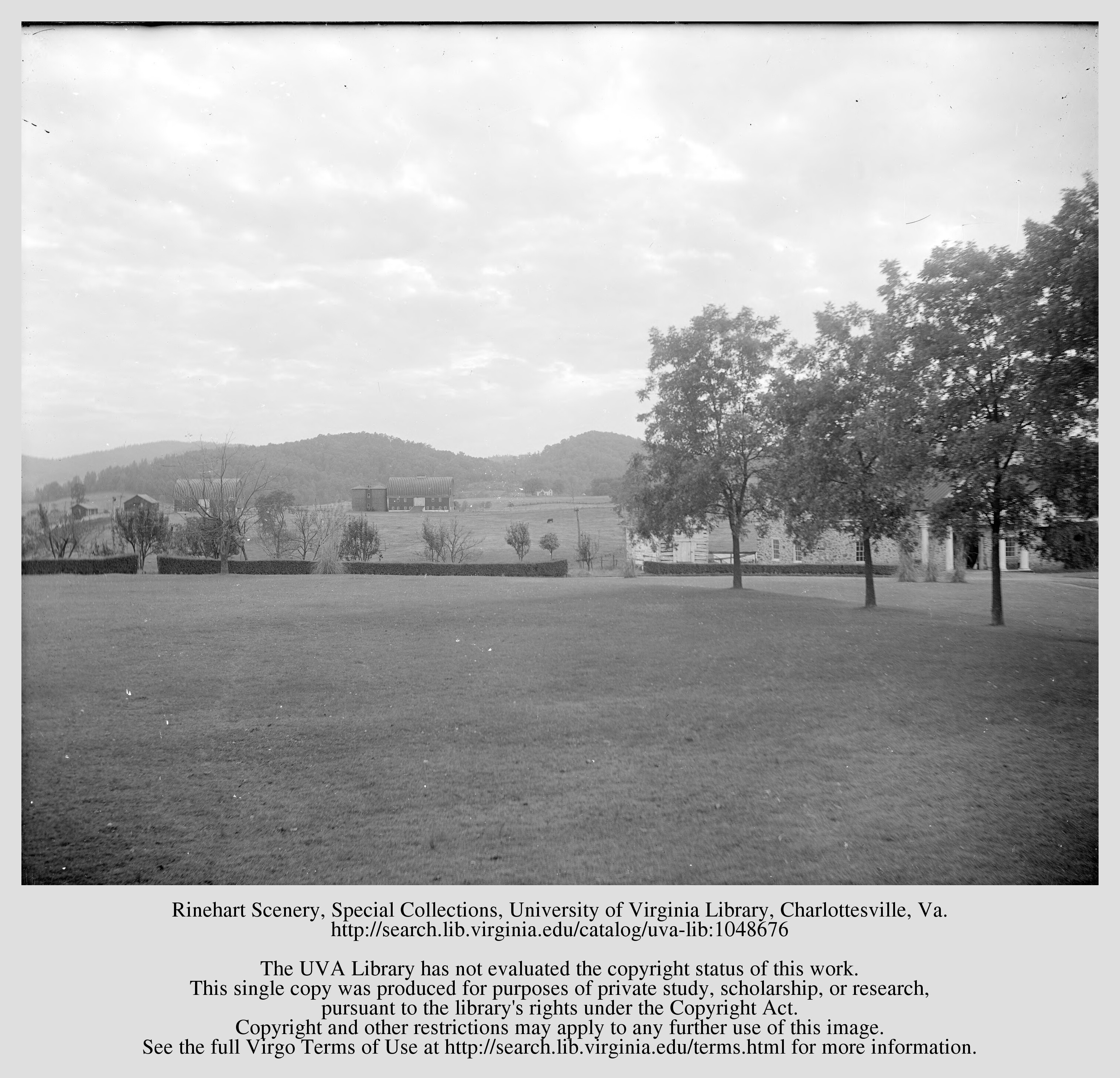

Figure 3: 1928 Charles Gillette plan of the manor house and proposed gardens
Figure 4: 2005 aerial view of the area
Figure 5: 2013 aerial view